
There’s a wide range of tools used by architects and planners to communicate the potential impact of major projects. Drawings, for example, are one of the most basic, as are masterplans, market studies and environmental surveys. None of these, however, are quite as accessible and powerful as a series of interventions being developed for the CityScope Project at MIT’s Media Lab.
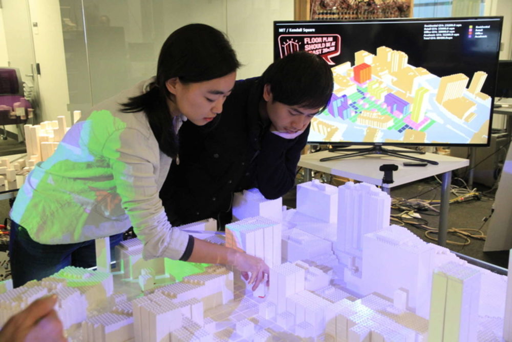
CityScope uses augmented reality to quickly and simply model the effects of large-scale urban-planning decisions. The technology employs special LEGO bricks on a tabletop with overhead projectors that beam color-coded metrics onto each brick. Every LEGO piece is assigned a user-determined variable such as “200-unit residential building,” “10-acre park” or “4-lane road.” The bricks are then assembled on the tabletop to represent an existing neighborhood, city or region, and users are able to pick up and move, remove or insert individual components at will.
As the components are modified, a special chip in each LEGO piece communicates with the overhead projectors, which beams metrics affected by each decision onto the new configuration. For example, if you placed a “200-unit residential building” piece onto a previously empty plot of land, the color of the street in front of the new building would change to indicate a quantifiable increase in traffic density.
Despite its apparent simplicity, the value of this technology is enormous. Currently being deployed in a limited number of situations around the world, applications have been developed that inform such arenas as building legislation, transportation systems and supply-chain logistics.

CityScope set up for a workshop on form-based zoning
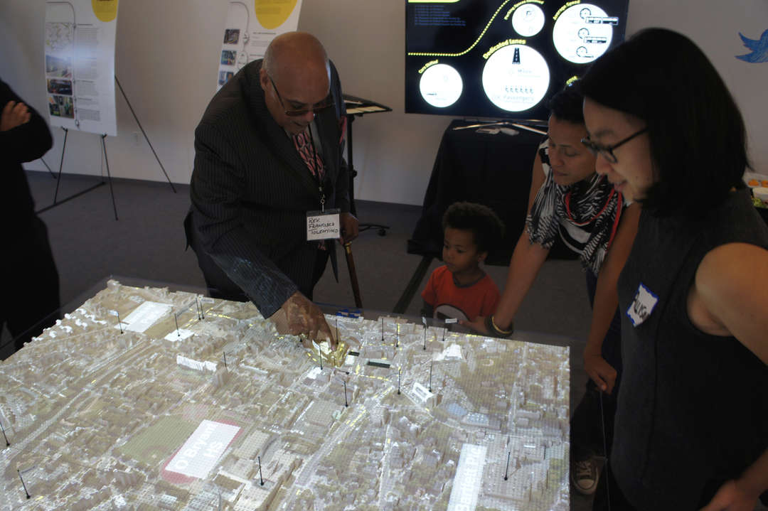
In terms of legislation, the CityScope method is well suited to model the physical effects of zoning and building regulations. For many cities, such regulations are the only proactive tools available to guide what’s built within their borders, but a frequently byzantine level of complexity often renders them unknowable to all but those who enforce them. By tagging LEGO bricks with properly scaled metrics of population density, land use and access to amenities like parks and public transit, CityScope can drastically increase the efficiency of planners needing to modify regulations, architects attempting to design within them or a layperson’s understanding of how a change in rules will alter the neighborhood they live or work in.
CityScope’s power as a legislative tool is best understood by its potential role in public meetings. Often a bottomless repository for hyper-local concerns, public meetings regarding zoning or building projects tend to leave planners with little recourse beyond displaying renderings or dispensing platitudes to communicate with their constituency. CityScope can fundamentally alter the effectiveness of such meetings by allowing the public to easily interact with the physical laws of their city, exponentially increasing their understandings of any decision’s interrelated effects and informing their opinions or votes to a level previously unavailable in the governing process.
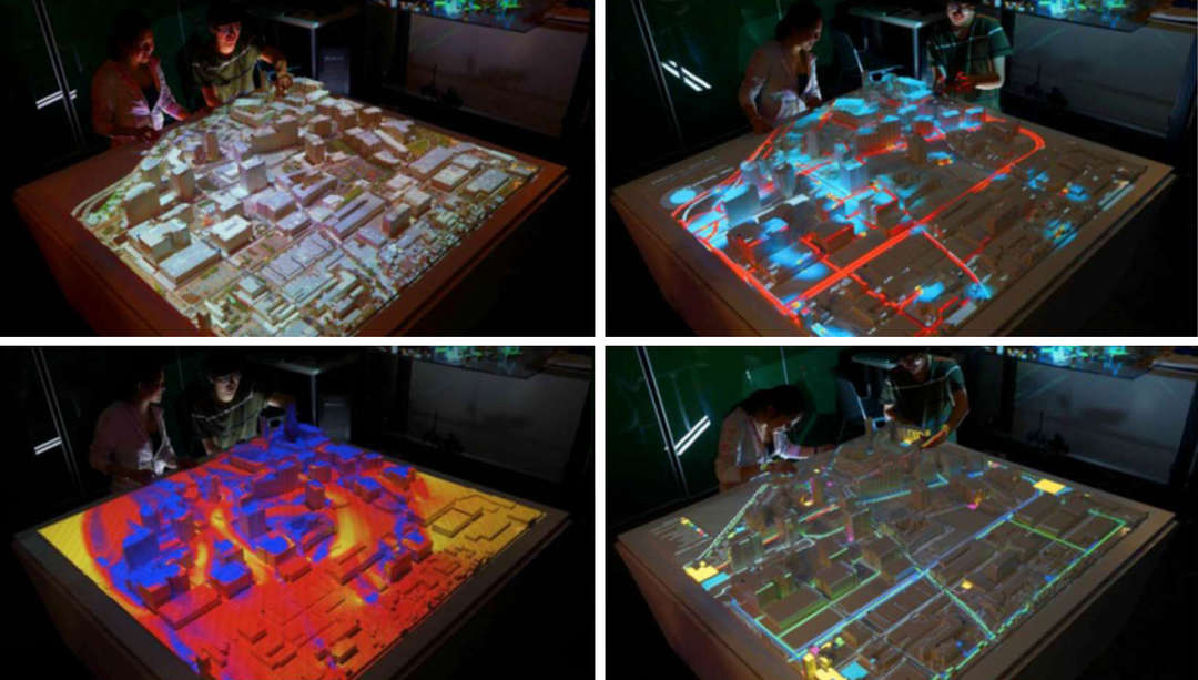
Participants work on a proposal for a Bus Rapid Transit system in Boston.
Major gains in using CityScope for the planning and maintenance of transportation systems comes with its ability to quickly and simply model complicated metrics like trip generation, carrying capacity and level of access. New systems can be planned with an easily modifiable, data-backed analysis, while existing systems can use the platform to plan expansion and maintenance in the most effective and least disruptive manners.
Perhaps most important is the ability CityScope offers transit agencies to easily impart the complex reasoning behind their decision making to an often pessimistic public. Distribution of a digital animation made from a CityScope simulation could allow agencies to provide a much higher level of transparency and accountability than we’re used to today. While this probably won’t pacify all a decision’s critics, it can at least produce a more informed dialogue among the public, at best becoming an open source tool for anyone to make their own suggestions over changes to transit service.
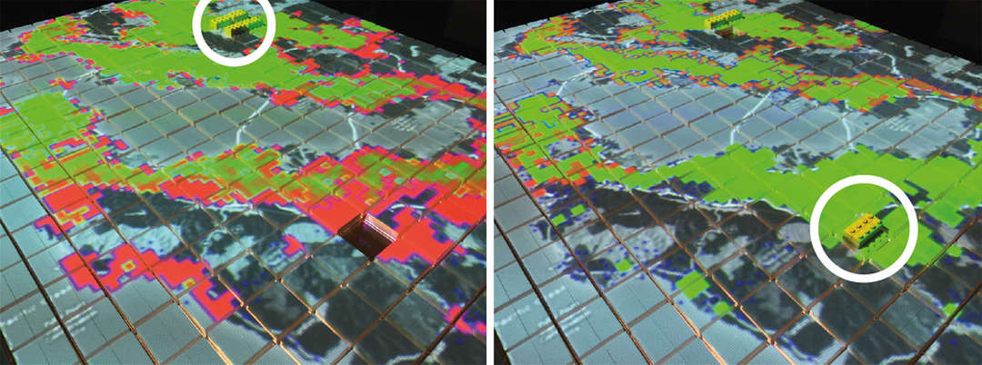
Modeling delivery capabilities in the Bay Area based on the location of distribution centers
The modeling of last-mile delivery systems at a citywide and regional level brings to light this technology’s promise in private-sector applications. The interactive display of real-time traffic and logistics data is extremely valuable for companies like Amazon — whose reputation rests on making speedy deliveries — pushing to reach near-perfect efficiencies.
At a larger scale, however, the CityScope platform could potentially model the supply chain of an entire industry, at which point its value may lie in an ability to simply quantify the amount of stuff moving around the world at any given moment. Paired with detailed metrics for exactly how specific items are being moved, research into environmental effects inflicted by the sheer amount of traffic created from moving consumer goods would become substantially easier.
Despite a relatively intense setup, the effectiveness of this technology is extremely significant. How it develops in the future remains to be seen, but the notion that it could eventually affect the design of buildings in a similar manner as it affects the design of cities isn’t difficult to imagine. Whatever the application, the beauty of CityScope rests in its ease of understanding and simplicity of use and is a promising example of a technology that adapts to the actions of people instead of the other way around.